Sunday, August 29, 2010

Grandaddy Lake

I'd been wanting to hike up to Grandaddy Lake ever since I read about it in the spring. It sounded like a nice easy trail for kids to come along. It was not very steep, and it was only about four miles.

We drove up to the Grandview Trailhead up in the Uintas. And here we are at the trailhead around three o'clock.


This is Alex about twenty to thirty minutes up the trail. He says he was pretty tired, but every time we stopped to take a break, he was bouncing off all the trees and rocks. He was a trooper.


He wanted a turn with the camera, so there I am and there's the trail going up behind me.


This next one is just before we got to our camp. We were probably about a half mile or so from Grandaddy Lake.


When we arrived in the area, we first found a place to set up camp. Then we went exploring down to the lake. It was very pretty with the sun already behind the mountain, but still shining on this mountain and reflecting off the lake. It was awesome.


The next morning after we packed our bags up and ate some breakfast, we went down to the lake again. This time to a different spot. I couldn't believe how still the water was, and with the sunrise coming up over the lake it was really pretty. When I pointed the camera at Alex and asked him to smile, this is what he did. I don't know where he got this from, but he has done this for a year or so at random times. He just likes to be goofy.


The trees reflecting in the lake here was awesome. It was very nice to be able to see this before heading back down the trail. It would have been nice if we had been able to stay up there for two nights.


And here we are together. I had a lot of fun spending some one-on-one time with my son.


Again, just beautiful.


I only carried him this little bit down to and back up from the lake. He walked the four miles up to the lake and four miles back down to the car.


We needed a rest about every twenty minutes. I think it was a focus thing more than anything else. He just couldn't focus on walking for very long at a time.


He's a cutie.


And this is our last little rest before reaching the car.


Yeah, we finished.


I think Alex had a good time. I sure did. I think I'll come back here again. It is a really nice area. Maybe next time I'll have more time to explore some of the surrounding lakes.

Thursday, August 26, 2010

Desolation Lake

I have done this run several times. I enjoy this trail because most of it is pretty easy to run on. I also like the fact that I can run up to a ridge and look down into park city. Like I said, I've done this run before but this is the first time (recently at least) that I actually brought my camera. Here is a picture of the lower part of the trail.


I start this run at the Mill D North Trail head. It starts of by climbing the canyon while paralleling the hwy for about a half a mile or more, then it turns north and heads up the canyon. About a mile or so up the trail there is a little stream that it comes close to and the trail opens up a little bit. It is a nice little spot. Continuing on another 0.6 miles it continues to climb. There is a fork in the trail you can either go to the northwest up to Dog lake (which is a short steep climb of about 0.6 miles) or you can head right (northeast) up towards Desolation lake.

Heading northeast now the trail climbs quite a bit in just a short while, then levels out to a more gradual climb. From that fork in the trail according to the trail signs it is 1.9 to desolation lake and 1.6 back to the trail head. Both up and down I can cover the distance in just about the same amount of time.

It's too bad that all this water is part of the Salt Lake Watershed. It would be nice to take a quick dip in the lake to cool off. It looks so like it would be so nice.


When I am limited on time, I turn around here making the whole trip about seven miles. I really like going up the next 0.6 miles to the ridge that looks down into park city. In this photo you can see part of Park City.


That is usually where I turn around making the whole trip about 8.2 miles. But this time I decided to find a way up to the top of the peak that is right there. It does not have a name on my map but the elevation is listed as 9990, so that sounds like a good name right? I thought that there would be a trail to the top of it since the main trail goes pretty close. But I was wrong. I was on the north side of it and I followed the main trail (which is the Great Western Trail) around to the south of the peak and didn't see any trail that went up, so I had to slow down and just hike the last little bit up. I tend to be pretty cautious with things like this because I really don't want to twist an ankle. So, I've conquered 9990 once and I don't think I need to do it again. Next time, I'll continue up the Great Western Trail until I need to turn around.

Here is a kind of blurry shot of me as I'm coming down off that ridge back towards Desolation Lake.


I really enjoy being able to fly down the mountain coming down the trail. Going up I do about a 12-13 pace and coming down I can do about a nine minute pace. It seems like I should be able to do more than that, but like I said I tend to be really cautious, maybe overcautious, because I really don't want an injury. I am usually by myself up there and wouldn't want to get stuck because I twisted an ankle so bad I can't even walk down. anyway...

Here I am back at the trail head after finishing the run. As much as I love being up in the mountains it always seems nice to get back to the car.

Sunday, August 15, 2010

Moon Lake Run/Hike

So a couple of weeks ago, we went up to Moon Lake with a bunch of my cousins, aunts and uncles. We got up there on Monday afternoon. I really like moon lake because of the mountains. I also like the fishing, but I didn't get a license to be able to go fishing. Well one of the things that I wanted to do when I was up there was to go up the canyon to Brown Duck Lake. I decided that Tuesday morning would be the best time to go off by myself for a couple of hours.

Tuesday morning my alarm went off at 5:45 a.m. I didn't hear it though and at 5:50 Amanda nudged me and told me my alarm was going off. Sure enough, I'd slept through the alarm. I'm glad I didn't completely sleep through it. I climbed out of the tent and finished getting my bag ready and my running stuff ready. I knew I'd be gone until noon, so I packed three powerbars, a couple of energy gels and I filled my three liter camelbak. I thought that would be enough. So, I got on the trail by about 6:10.

The trail leaves Moon Lake Campground and goes up to the west following Brown Duck Lake. After a couple of miles you cross into the High Uintas Wilderness Area. The first "wild"life I saw was cows. It surprised me because I thought that since it was a wilderness area, ranching wouldn't be allowed. That's alright though. I managed to fight of the cows and survived. It was about eight o'clock when I got to where the trail split off to East Basin. I kept going on the trail to Brown Duck Lake and then on around to Island Lake. I wanted to go to Kidney lake but that would have added about a mile and I didn't feel like I could take the time. I had a long run in front of me, and I didn't want to fight any more cows. So I turned around and went back to the trail that split to the north to East Basin. I still hadn't seen any people. I was a little surprised that I didn't see anyone one the trail, or camping at the lakes.

This was a photo of Brown Duck Lake.

And here is a photo of Brown Duck Creek that goes down to Moon Lake about six or seven miles down the trail.


Well the trail up from Moon Lake to this point was mostly runable. It was a bit steep but at least there were not too many rocks in the trail. The next portion of it was mostly level, but there were lots of rocks in the trail that made it hard to run on. I still kept up a pretty good pace (well, good pace is relative here, it was probably like a 10 minute mile here). After a couple more miles, I passed a lake and thought I had lost the trail. The trail went straight into a meadow and I couldn't see any sign of a path through the meadow or a path on the other side of the meadow. I turned around and thought maybe it followed the lake a little bit. I came upon a guy camping with his son. They were having breakfast. They pointed me in the right direction and walked with me across the other side of the meadow. When we got to the other side it was obvious which direction the trail went. After running for another couple of miles, I came up over East Basin Pass. I didn't realized I was coming up to it, but then I passed it and the trail went down a pretty steep rock slide area. I paused to see if I could tell where the trail went. I couldn't see the trail, but I could tell where it went based on the map that I have.

The trail continued down into East Basin and then up a little into a nice little forested area. Pretty soon I came to a sign that said "East Basin Creek." It was located in a nice little meadow area with a creek running through it and several little lakes. I took a break right at that sign to eat a powerbar and take a good look at the map.


I continued on and crossed the creek. I ran up the last little hill from hear up to Cleveland Pass. It was nice up there. It was pretty flat, not many plants, and there was a cool lake up there. If I had more time, I probably would have hopped in for a little swim. Maybe next time. By the time I got to Cleveland pass it was about eleven o'clock. The GPS said that it was 14 point something miles. I had been going pretty darn slow. oh well I was having fun and it was all downhill from here. I told Amanda that I'd be back to Moon Lake by about noon, well, I knew that wasn't going to happen but I figured I should be able to get there by about one since it was all down hill. By this time I had eaten two powerbars and had probably drunk about half of my water. It was really pretty up there too. I took several pictures before continuing on down the trail. Here is a picture of the peak right behind Cleveland Pass.

Here is where the trail splits. I came from East Basin and I was headed over to Ottoson Basin. It was all down from here.


I think this lake was pretty cool. It might be a fun lake to camp next to some time.


This picture is looking down the valley to the east coming down from Cleveland Pass.


This is a picture of Ottoson Basin looking to the North. I think that peak on the right is East Lavina. It could be one of a couple others, but as best as I can tell from Google maps right now, it looks like Lavina. I don't have my good map with me right now. I really love the mountains. I really love being alone in the mountains. It is so peaceful up there. I love being in nature. Every time I see the mountains I am in awe. I sometimes wish I could live in the mountains.


Here is a picture coming down Ottoson Basin. As I was running I startled a couple of elk that were near the trail. I grabbed my camera in an attempt to get a picture of them, but I couldn't. I thought maybe there would be some more, but no luck. I took this picture of a meadow like the one where I saw the elk. I enjoy seeing wildlife. It was much better than the cows I saw a couple hours earlier.


And here is a photo of a river I had to cross. I stayed on the north side of this creek the rest of the way down Ottoson Basin to the junction of Lake Fork Trail. In fact it was a mile or so on that trail before I crossed that creek.


It only took me about 40 minutes or so to get down this portion of the trail. My guess is that it was about four or five miles. I was able to go pretty quickly. I was getting pretty tired by this point, but I figured I had about seven or eight miles to go. Afterwards I now realize it was probably more.


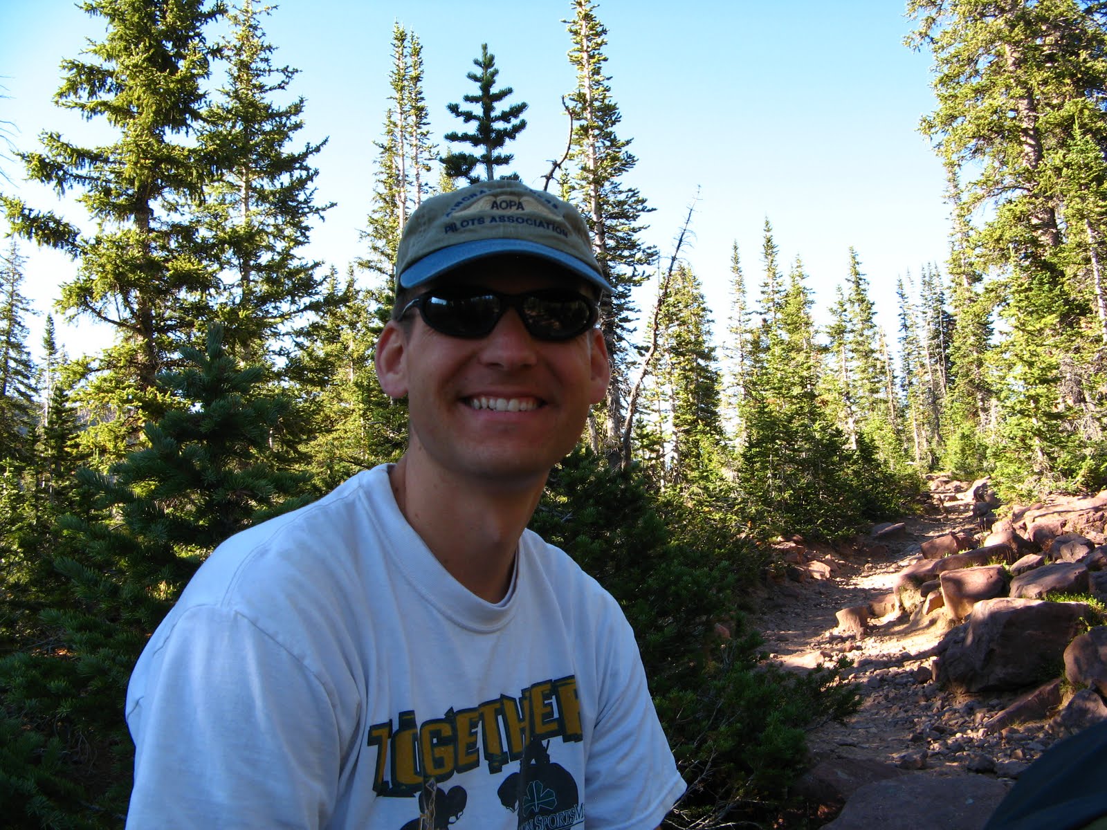
Here I am as I am leaving the High Uintas Wilderness Area. I ran completely out of water right in here somewhere. It was another 15 or 20 minutes before I could see Moon Lake, and then I really felt like I was close. I kept worrying about the time. I knew Amanda was expecting me about noon and it was already two o'clock.

It took about thirty minutes to get to the other side of the lake once I saw it, and about half way through this portion I noticed that I stopped sweating. My skin was sticky and there was no sweat. I didn't feel faint or nautious or anything like that, I was just tired. It was like the end of a marathon where if I kept running it was okay even though it was taking a lot of energy, but if I stopped to walk, it was practically impossible to continue running. I was chanting cadence to give myself motivation to keep going. It worked well too. I would have just slowed down and walked, but I knew everyone back at camp would be worrying about me and thinking I was eaten by some wild animal, so I kept my pace up. I got back to the cabins where everyone was located about 2:40.

Before I left I thought that it was about a 25 mile loop. Afterwards I felt like it was more like 35 miles. Now, looking back at it, I think it was probably about 28-30 miles. On my running log on runnersworld, I marked 28. I think that was probably right. I am so glad that I did that run/hike. It was nice to be alone in the mountains. Afterward I hopped in the lake to help cool off my legs. The water was cool enough to be an icing, but without really being ice. Well, that was pretty long, but I hope you enjoyed seeing the photos.

Friday, August 6, 2010

Wildcat Canyon Run, Zion National Park

After the run up Angels Landing we came down and had dinner. We then drove up to the Upper Kolob Plateau part of Zion National Park. There is a little campground up there with six spots, but it was all full. We drove up to Kolob Reservoir and camped next to the lake up there. It was a really nice spot to camp. On Thursday morning we drove back down to the Lava Point trail head.

We ran out about four and a half miles and back making it a total of probably about nine miles. From this trail head you could run out the West Rim trail, or the Wildcat Canyon trail. We took the trail to Wildcat Canyon. Despite the name, we did not see any wildcats. We did however come accross two snakes. The first was about two miles into the trail. This rattlesnake was coiled up right there on the trail. I didn't see him move at all. We walked around him keeping our distance, and we marked the trail so that we would know where it was when we came back.

The rest of this run was pretty fun. This was definitely a faster run than Angels Landing. We wanted to run out to a lookout point, but we also didn't want to run too far. We didn't make it to the point. We turned around at about 45 minutes. It took about the same amount of time to get back.

On the way back we saw a King snake. We also saw the rattlesnake again. he had woken up and was slithering up the hill away from the trail.

Here is a picture of that rattelsnake we saw. Ryan was running in front and he freaked out when he saw it. I would have to if I had seen it first. Since I knew it was there I was cautious when i aproached to take a picture.


Here is Ryan at the point where we turned around.

And here I am at that same point.

Here is a view from the trail.


And here is a picture of that king snake. We weren't sure what kind of snake it was, but I looked it up when we got back and it is some sort of King snake. It is kinda hard to see, but there it is.

Here is another photo of that rattlesnake. I guess the sun hit him and he warmed up enough to move by the time we got back to him.


And this last photo is of us running. I was holding the camera in my hand, turned it on, held it up and snapped this shot while we were running back up the trail to the trail head. I was pretty tired at this point.


In all it took us about an hour and half to do this run of about nine miles. Not great time, but I didn't stop my watch for the snakes and other photos, so overall not bad. After this run, we hopped in the car and headed home. It was a really good trip to Zion National Park. Next time I hope there will not be a threat of flash flooding so that I can do the whole Narrows hike.

Angles Landing

So, After we finished hiking the Narrows, we rode the shuttle bus down to "the Grotto." That is where the trail starts to hike Angels Landing. We decided to ditch our bags and walking sticks in some bushes off the trail and run up it. It was a great idea for the first mile or so. Then the going got really steep. It was still a good idea, but Ryan is in much better shape than I am. After about a mile or so there are several switch backs that eventually lead right up the side of a cliff, literally. The cliff was carved away for the trail. It was getting pretty hot and I didn't have my running clothes on. I just had my normal shorts and a cotton t-shirt. Not the best running gear, especially when it is so warm out. Anyway, after about two miles we got up to the pass, then the trail comes back and up this really steep, narrow point.

This is where the cliff is carved away for the trail to go up.


Here is a video clip of how narrow and crazy it was up there.


They have these safety chains up there for people to grab onto because it is kinda dangerous and really, really dangerous if these chains were not there.


This is the top part of Angels Landing. See how crazy narrow and steep it is. I'm actually a bit surprised that they let people go up there. I'm surprised there are not more accidents or incidents.


And here is a photo of Ryan and I at the top. This is looking down the canyon back towards the visitor's center.


And this last one is Ryan having way too much energy. On the way back down he found this little crack in the side of the cliff, so he went and climbed up it. I managed to climb up to get the photo, but I didn't climb up like he did.


And that was the end of our Angles Landing run. It was really rewarding. We stayed up top for ten to fifteen minutes to rest and get some photos. Total mileage was five. It was 2.5 up and took us 42:43. Coming back down was also 2.5 miles and took us 33:17. Overall was 1:16:00 for five miles. Not the best time, but when you consider that we were basically climbing up a cliff for the last half mile and it was really steep with lots of switchbacks before that, yeah it was pretty quick. We passed a lot of people that thought we were crazy, what do you think? Are we crazy? I think we are.

Sunday, August 1, 2010

The Narrows

So, when we went down to Zion National Park, we were planning on getting a permit for campsite number 2 on the Virgin River half way down the Narrows from the top. The total hike is 16 miles, and campsite number two is about 8 miles in at the confluence of the Virgin River and Deep Creek. I had been really excited to do this and had been looking forward to it for several months.

We drove down on Tuesday afternoon and found a spot to camp at the campground just inside the park entrance. We got up at 6:00 am in order to be down to the back country permit office to pick up our permit for the hike. I had been watching the weather forecasts and knew that there was a chance of flash flooding. It had been moderate for the last few days, but in the morning when the forecast was posted it called for 50% chance of thunderstorms for Wednesday and Thursday, the days we would be in the canyon. The flash flood potential went up from moderate to high for both days. And they decided to issue a Flash Flood Watch. That means that "conditions are favorable for flash flooding." The next step is to issue a flash flood warning, which means that there is flash flooding occurring or radar shows rain heavy enough to produce flash flooding within the next 20-30 minutes.

Well, I was still excited and I got the permit from the back country office. When I got back to the car, my friend talked some sense into me and said that he did not feel comfortable going. We drove over to the place where we were going to catch the shuttle to take us to the trail head and talked with those people for a bit. After talking with them, I was convinced that it was not a wise idea to spend the night in the canyon with this high potential for flash flooding. They had already seen the river rise a little bit, and it had changed to a murky color. Rain and excess debris in the river are the other two signs of flash flooding.

Since we were not going to camp in the canyon, we decided to do a day hike up into the narrows from the bottom. The trail head is at the Temple of Sinawava. You have to take a shuttle to the trail head. They don't allow cars up that far to reduce the number of vehicles up the canyon. The first mile is on a paved path. It is pretty easy. After that you jump into the river and hike up the river for as far as you would like to go. Back at the Zion Adventure Company that was going to take us to the other trail head, we decided to rent a couple of walking sticks. On the shuttle ride up and for the first mile on that paved path, I was starting to regret the five dollars I spent on it. As soon as I got in the water though, I was very grateful I had it. It made walking through the river so much easier.

It was lots of fun and we stayed cool because of being in the river so much. I just had an old pair of running shoes on. They worked just fine. I was pretty cautious with my footing even though we were going pretty quickly. We passes several people. The first set of photos I took was at the junction of Orderville Canyon.


This was looking back down stream from where we had just been hiking.


And that is me enjoying a couple minutes rest. We decided to grab a quick bite to eat right here. We were stopped for maybe 5-10 minutes. Ryan ran up Orderville Canyon for a minute just to take a look around the corner. The canyon is coming out from my right (your left) you can see the water behind me.

We hiked up for quite a ways. I am pretty sure it was at least four maybe even four and a half miles up the canyon before we stopped to turn around. At that point we decided to stop and have some lunch. We stopped for 20 minutes or so. I took some photos there too.


This is where we took our lunch. This is looking up the canyon a bit more. It was a nice little area, until the sun hit us. Because of the slot canyons, the sun was not hitting us for most of the hike. It got pretty hot when we were not in the river and sitting in the sun.

This photo is looking up the canyon (north) at the top of the canyon walls. It was so cool to see these canyon walls going so high.

This one was looking straight up from where I was sitting, eating my lunch. We contemplated how we would climb out if a flash flood came and we needed to escape. In reality if a flash flood came, we would be able to climb to high ground, 6-10 feet above the river level and sit it out while the river drained out.

There were several places in the river that we had to go pretty deep. Here is a photo of the deepest part.


This is Ryan.


And that's me.


This is not a great photo of me, but you can see the walking stick that I was using. You also notice that I was carrying my backpack Even though I had all my stuff in plastic zip-lock bags, especially my camera. And all of that stuff was inside a big garbage back. All of my stuff stayed dry. I didn't want to completely submerge my bag though, so I took it off and held it above my head.

Overall this was a great hike. On our way back down we hiked about a mile up Orderville Canyon, so total we hiked 10-11 miles and it took us six hours overall. The next day when we were driving away from Zion National Park, we heard that they had issued a Flash Flood Warning, which means that flooding was occurring somewhere. I think I'm glad, even though I really wanted to hike the whole thing, that we decided to only go up for a day hike.

On that same day we ran up Angels Landing, which needs a whole blog post to itself. And the next day we ran Wildcat Canyon in the middle part of the park. It was amazing, so I'll save it for another post, if I have time to do it.