Monday, September 27, 2010

Little Cottonwood Trail

So a friend asked the other day about this trail. I had only attempted this trail once and it was closed. That was about a month after the flooding earlier this year. I was a little surprised to see this sign at the trail head indicating that the trail was still closed. Since I didn't see any damage or trail blocks, I decided to go up to see where it was actually closed. I passed several people and then I didn't feel as bad about being on a trail that was supposedly closed. On this lower part of the trail I passed to places where the trail was actually closed. It looked like they had been doing some work to fix it up a bit. One section was closed for 200-300 yards and then another section was closed for about 50-100 yards. There was no one working on the trail, and I saw others going up, so I continued up the trail. I felt bad about this and so when I reached the top (Tanner Flat Campground) I went out onto the road so that I didn't have to run on the closed trail.

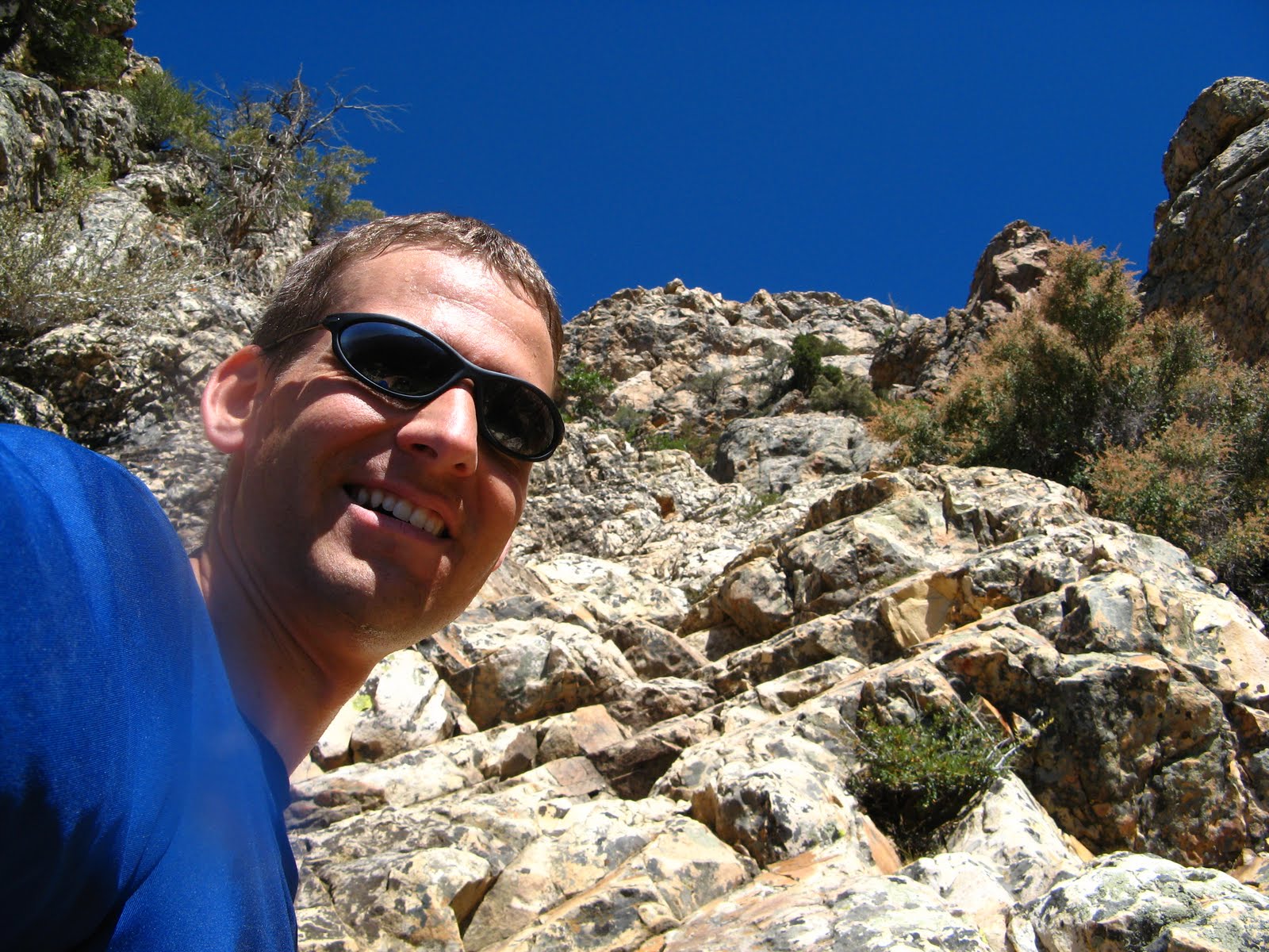
That's me on the lower section of the trail.

It was actually a very nice runnable trail for most of the way.

Like I said, most of the way. This was a short section towards the top before I got to Tanner Flat.

I love the fall colors that are now very prevalent in the canyon.

This is as I was leaving Tanner Flat Campground. The trail came into the camp on one of the loops. The upper portion of the trail looked a bit newer than the rest of the trail, but it was still a well developed trail. Even though the trail was closed in a couple places, it still seems like a popular trail. I saw many mountain bike tracks and foot prints. I saw a couple of people hiking, and a couple of mountain bikes too.

I like getting pictures of me as proof that I've actually been somewhere. This is where I came off the trail and down the road. I drove this portion to measure how far it was and my car said 4.1 miles down the road. I'm guessing it was a little more, like 4.5, on the trail, I'm not really sure, but that seems about right.

I thought that this run on the road down the canyon would prepare me a bit for the Halloween Half marathon that comes down Provo Canyon. My pace coming down was about 7:20, my pace going up was about 11:30 if it was only 4.5 miles. I guess that is about right.

I like the view down the canyon into the Salt Lake Valley.

That was a pretty good run overall. I won't be back thought until they fix that trail. It seems like they are taking there time getting it fixed up. It seems like it would be a good trail for snowshoeing in the winter. They just need to get it fixed. I wonder if the trail continues up the canyon on the other side of Tanner Flat Campground. I was a little surprised to see that it was still open. There was a sign that said the campground is open until October 11th. Maybe I'll come up here with my family before it closes. Probably not though.

Last night I was reading about this crazy run that people do in the Grand Canyon. They call it a R2R2R, which means rim to rim to rim. It is about fifty miles and they start from one rim of the Grand Canyon, go down to the Colorado River and back up the other side, then they turn around and do it again the other direction. I really want to do it. I think it would be a good training run for the Moab 100. I am still planning on running that in March. I just hope I am still here to run it. I might actually be gone and if that is the case, I just might go down there and run it on my own. I got so excited that I could hardly sleep. I just kept thinking about getting out of bed and going for a run. I could have ran all night. I finally fell asleep about two hours after lying down in bed. I plan to run either the R2R2R run or a Zion traverse (from one end to the other in Zion National Park, also about 50 miles) in November with a running friend of mine.

Monday, September 20, 2010

Timp Run

Last Friday evening I decided I wanted to go for a good trail run. Since I had yet to climb Mount Timpanogos this summer, I decided it was about time. I figured that if I got up at five I could get to the trailhead by six and be up and down by nine, be home by ten and Amanda wouldn't get upset at me for being gone all day. It started out as planned, but then when I got to the trailhead it was packed. There were tons of people and I ended up having to park about three quarters of a mile from the trailhead. That added a bit to my time. There were also so many people on the trail that I kept having to slow down and ask to pass them. I'm not complaining, but if there weren't so many people I surely would have been home by ten. As it was, I didn't get home until eleven thirty.

This is the first picture that I took. It is a couple of miles up the trail, looking out to the east. The sun was just coming up and this is the spot where I put away my headlamp.

That's me and the uphill part of the trail behind me.

Not a very good picture, but that is looking up toward Timp. I think Timp itself is actually to the left side out of this picture.

Even with all the people I managed to reach the summit in almost exactly two hours. I always enjoy the view from up there. It was cold because the last little bit of the climb from the saddle is on the west side of the mountain which is still in the shade at this time of day. In this picture you can see Deer Creek Reservoir and Heber City.

This is looking down from the top to Emerald Lake. If you hike up from Aspen Grove, that is where the trail will take you. If you look closely, you can see some tents.


This is looking down into Pleasant Grove. I just thought that all of these cool fall colors were awesome.

This next one is looking to the north. The highest point that you can see towards the left side of the picture is the Pfiefferhorn. I did that one earlier in the summer one Saturday morning. It was also a fun one, and much much less crowded.

I had someone take my picture, so for once here is a picture where I am not holding the camera.

And here is another one.

On the way back down I almost missed these mountain goats. There was a guy with his video camera and I just thought that he was filming the mountains. After I passed him, I turned around and these four or five mountain goats were only about 20-30 feet off the trail. They are very, very common to see up here. I don't think I have ever been up here without seeing at least one. You just have to look for them sometimes. They are not usually this close to the trail.

After I got back down and started driving down the mountain, I noticed more awesome fall colors so I stopped the car and took this photo of the mountain. Have I mentioned that I love the mountains?

And that was my run. It was lots of fun. Oh, yeah, half way up I ran into a guy I'd run with a couple of times before. He was on his way back down. He talked about doing a 50 mile run in Zions National Park, or at the Grand Canyon. I have been wanting to do a R2R2R run for a while (Rim to Rim to Rim). I've heard a lot about people doing that where they start at one rim of the grand canyon, run down to the Colorado River then back up to the other rim, then turn around and come back to where they started. It is about a 50 mile run. I think it would be a perfect training run for the Moab 100. I think I will really try to do that with him some time in November.

Wasatch 100

So, a few weeks ago, I decided that since I was still in Utah and the Wasatch 100 was coming up, I would try to participate some how. I got onto the website and noticed that there was a section for people looking for pacers. I thought that sounded like a good way to help, so I emailed one of the people and they said they were happy for the help.

The race came and I met up with him on Thursday at the mandatory pre-race meeting. We talked about a few logistics and talked about where I planned to meet him. We decided on Brighton, mile 75, and that was that.

This is a photo he took at the top of the first mountain they climbed. It was probably some time around seven or eight when he took this photo. It had snowed earlier that night up there, but it warmed up enough durring the day to melt it off.

I'm not certain where this photo is taken, probably somewhere before Lambs Canyon (mile 50).

This is the Brighton aid station at Brighton Lodge. He was hoping to be there by about ten o'clock, but he didn't get there until about 12:40 am. Luckily I was able to follow him online. They had a good system of posting the times into and out of aid stations, and they were pretty good at estimating the time of arrival at the next aid stations. I left my house about eleven o'clock. Amanda came with me so that the car wouldn't be left up there.

It was freezing cold, I'd say it was 25 degrees at the top of the climb out of Brighton. The car thermometer said it was about 30 degrees at Brighton. We left this aid station just before 1:00 a.m.

From there, it was a climb up and over Catherine's Pass. That was the highest point on the whole course, 10,450. Phil was pretty tired after having already traveled 75 miles on foot, so it was mostly just walking. It was a pretty steep climb and the trail was not very good for running.

When we started going down the other side, the trail was steep and slippery. It was only about five miles to that next aid station, but it took about two hours. We were in and out of Ant Knolls aids station pretty quickly. As we were leaving they said that it was only about three miles to the next aid station. When we had been going for more than an hour, we started wondering if they were telling the truth. They were, but it was just really slow going. An hour and a half later, we got into Pole Line Pass aid station (mile 83). They had a big fire going, so I warmed my hands just a bit. I let Phil go on so that he would loose any time, and I stayed for another minute or two to grab an extra bite and warm up a bit. I caught up to him pretty quickly.

This section seemed about as bad, it was just slow going. But we did manage to pick it up a bit because we realized how slow we were actually going. It was four miles to the next aid station and it took us about an hour and forty minutes. This was Rock Springs aid station at mile 87. This was a remote aid station and they didn't have much. We filled our bottles up and took off pretty quickly. Shortly after we left Rock Springs, Phil's headlight went out. It's a good thing I was there for that. He probably would have gotten lost or had to slow way down and gotten hypothermia. It was really cold up there. I handed him my mini mag (my spare flashlight) and let him continue while I replaced the batteries in his headlamp with the AAA batteries that I had brought. When I caught up with him, he just wanted to keep the hand held light, so I put the headlamp away. It was dark for about another hour after his light died.

We hit the plunge and the dive and it seemed like this section just kept going and going, but at least we were moving faster. He was able to jog for most of this section, any time there was a down hill, we were running. The ups slowed us down, but there were not many along this section. We made it into Pot Bottom Aid Station from Rock Springs in about and hour and forty five minutes. This was the last aid station before the finish line. We were moving along at a pretty good clip coming into this aid station and Phil did not want to stop for long. We came in and he left within a minute, I stayed an extra minute or so to finish filling his bottle and putting in an electrolyte tablet.

The next stretch was a hill for about a mile. We walked up the whole hill, but when it started coming back down that was it, it was down hill to the finish, and we were jogging at a pretty good clip for most of this section. There was one place just after we passed the water tank, that Phil didn't turn when he should have, so I yelled after him and we had to turn around and climb back up that hill about 50 yards. That was it though, after that there was no stopping, we jogged the whole way to the finish. We started seeing more and more people. There were a couple of photographers, there were people cheering when we came out onto the street, then we just had a little more than half a mile to jog down the street.

When we arrived at the finish line, there were lots of people cheering. Amanda and the kids were there. They had arrived only a few minutes before, just in the nick of time. We crossed the finish line at 9:54 a.m. His time for completing the 100 miles was 28 hours and 54 minutes. Great job Phil!!! Here we are just after we crossed the finish.

And here we are just resting. It hadn't hit me yet that I hadn't slept all night long.


I am very glad that I was able to help Phil for the Wasatch 100. It was a great experience to participate in a 100 mile race.

This race has helped motivate me to really get out and prepare for my own 100 mile race. I have still only done the one 50 mile race two years ago. I've been looking around and I see that there is a 100 mile race in Moab in March. I think I will plan on doing that race and I will train for it. If I happen to still be in Utah for that race, then I will do it. If not, then maybe I will plan my own 100 mile run or something. Who knows? I just really want to run another big race. Right now I am planning on running the Provo Halloween Half Marathon on October 30th. I think I can get a PR. My best half marathon time is something like 1 hour and 36 or 37 minutes. I'm pretty sure I can break, 1:30.

Mount Olympus

So, if you are looking for a trail that is sure to challenge you, then this is it. It is 3.5 miles to the top and it climbs over 4000 feet. That is a very steep climb. I had the intention of running this trail, but it was mostly a walk. This is what the trail looks like right at the start. It climbs up, imagine that. It starts right at the foothills. Throughout the entire hike you have a great view of the Salt Lake Valley.

So this next one is more than half way up the trail looking down towards the valley. You can see the copper mine on the other mountain over there.


The last twenty minutes or so is spent almost rock climbing. It is not true climbing, but it is about as close as you can get without actually climbing the rocks. I never felt like I was in danger if I slipped. I would have just slid a little bit and knocked some loose rocks down.


Here is a view from the top. I think this is looking West northwest from the summit.


And that is me enjoying the sun and a short break at the summit.


I don't know why I took this picture. I guess I was really out of it from hiking so hard. I'm just a little weird. Maybe I need to send the picture to Amphipod so they can use it as an advertisement photo. That would be funny.


This is on the way back down the mountain. Since it was so steep, it was very difficult to run any of it.


There were actually a few spots that were pretty nice like this. This section was pretty runnable.


And I made it down safely.


I like this one for the fact that there is so much climbing. If I can manage to run up this one the whole way, then I would be in great shape. I'll keep trying and working towards it. For now, I'll stick to the other trails up big and little cottonwood canyons.